Today we set of to drive the first section of The Altlantic Way. This route covers 2500km of coastline from the south, along the west coast and the north. We’ll be more or less following this for the next weeks or so.
We actually did a little bit of it yesterday, but are counting today as day 1.
We woke to rain and the day looked like it was going to be a bit miserable, so we got our Iceland (so called because we bought them in Iceland a few years back) jackets ready for easy access, and at our first stop our shoes got a bit damp so we swapped to our wet/cold weather boots.
And wouldn’t you know the rain stopped, we only needed our light raincoats and even then we’d removed them by the time we finished at Mizen Head!
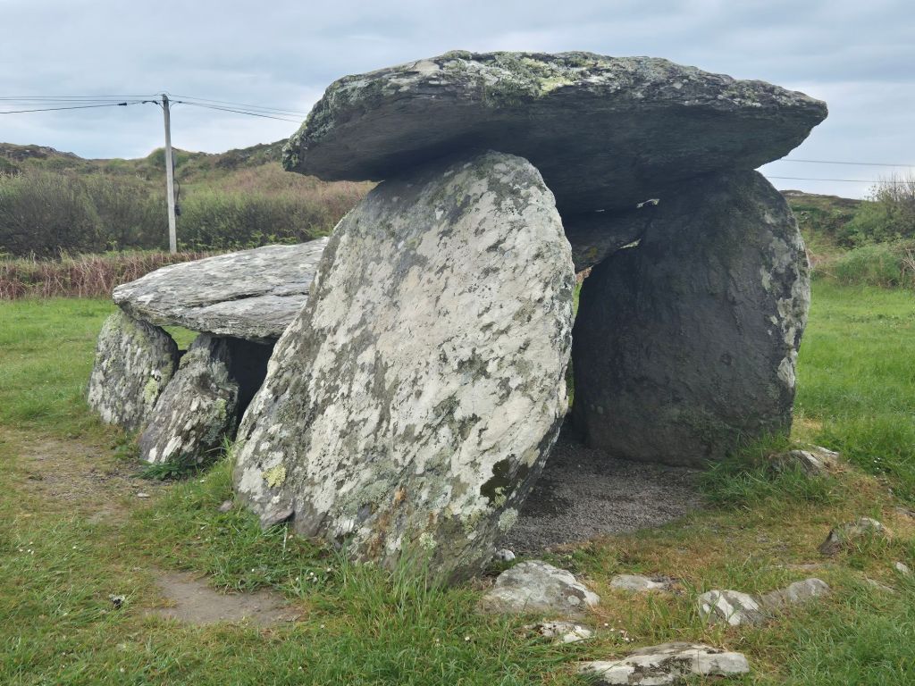
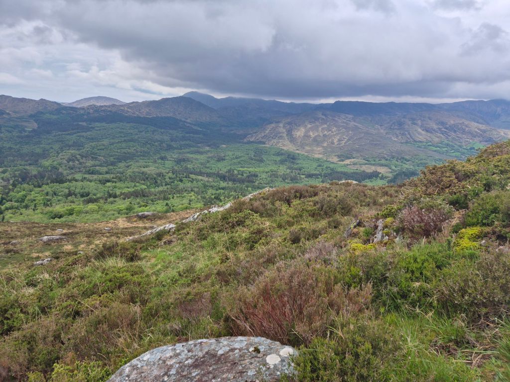
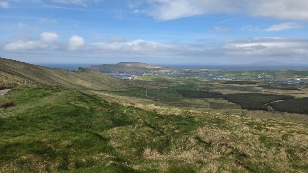
Today we started westwards towards Mizen Head, the most south-westerly part of Ireland, and drove around Schull and Toormore, stopping at the Wedge Tomb.
Then stopped near Griffins Bay for a bit of bird and seal spotting.
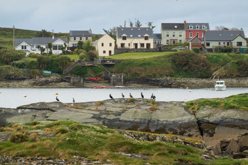
We did see a couple of seals, but didn’t get any decent (or even halfway decent) photos.
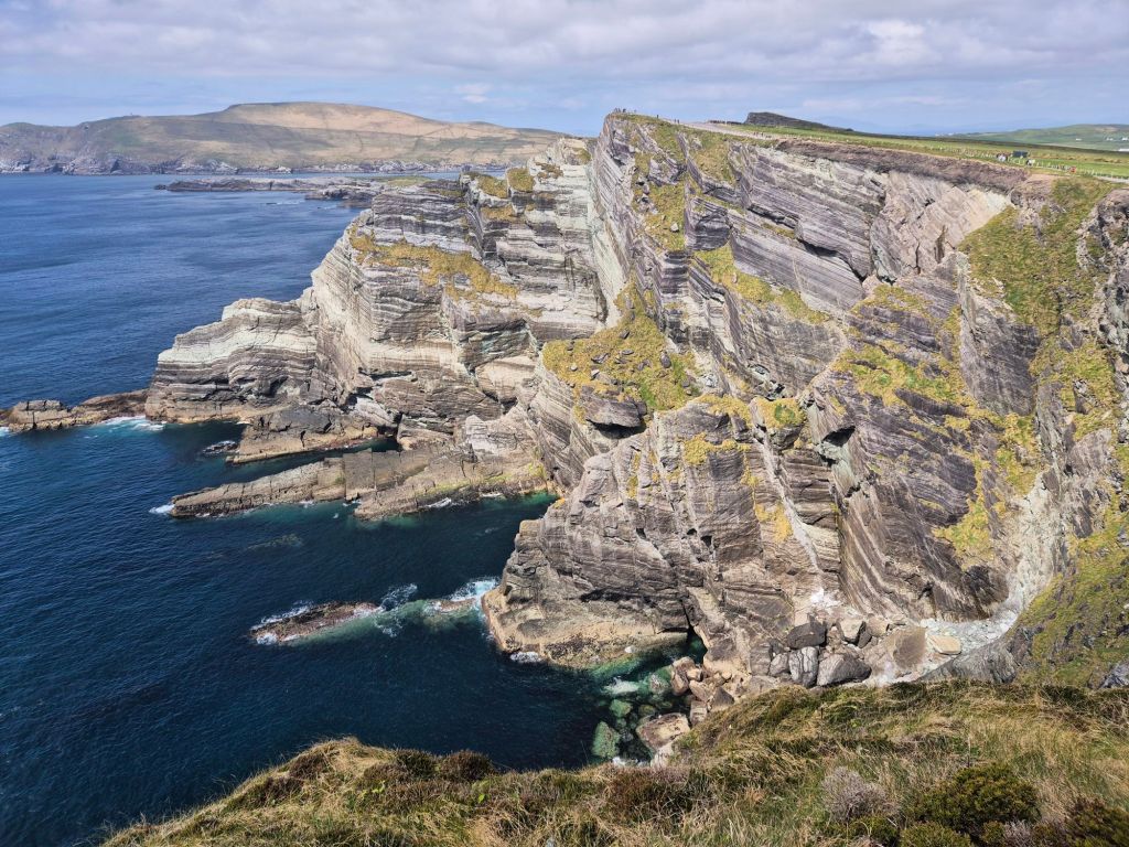
We then arrived at Mizen Head and walked out to the signal station.
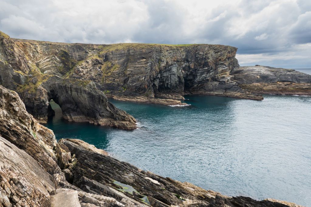
There are some stunning cliffs
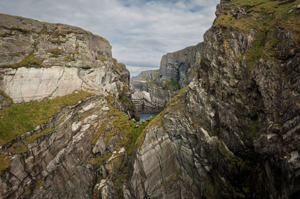
and at the very end a signal station that was built to warn ships of the treacherous rocks that are bountiful in the area.
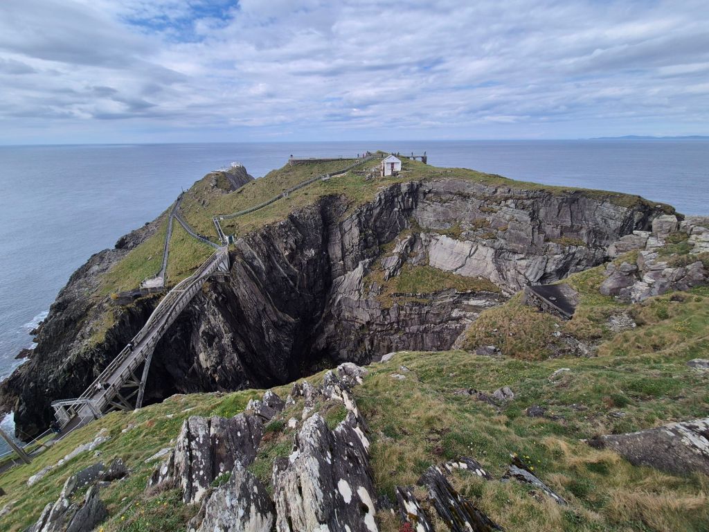
We walked around Mizen Head, up and down a significant number of steep pathways and staircases to get to the viewing points.
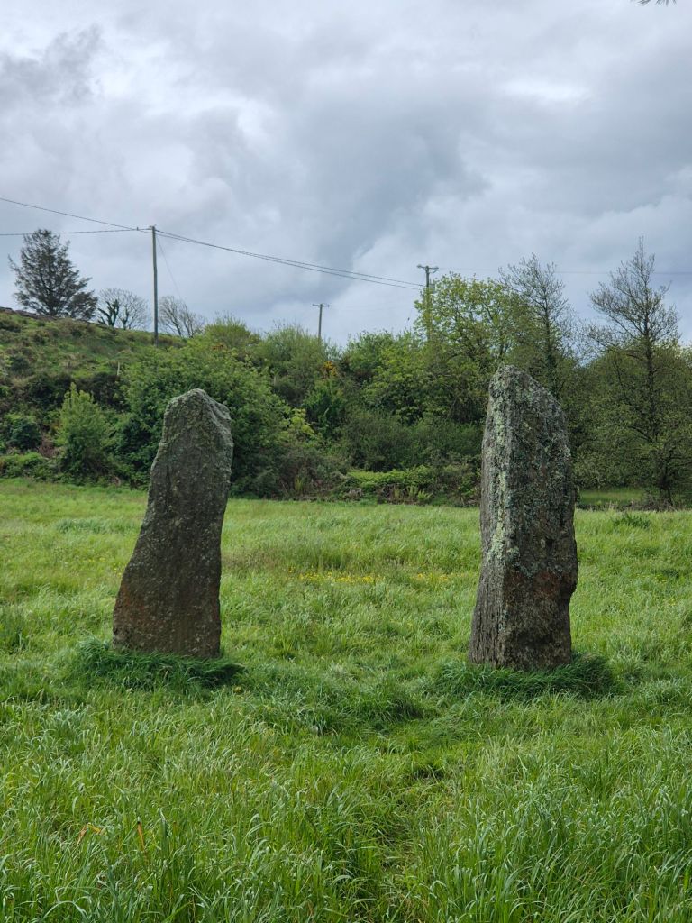
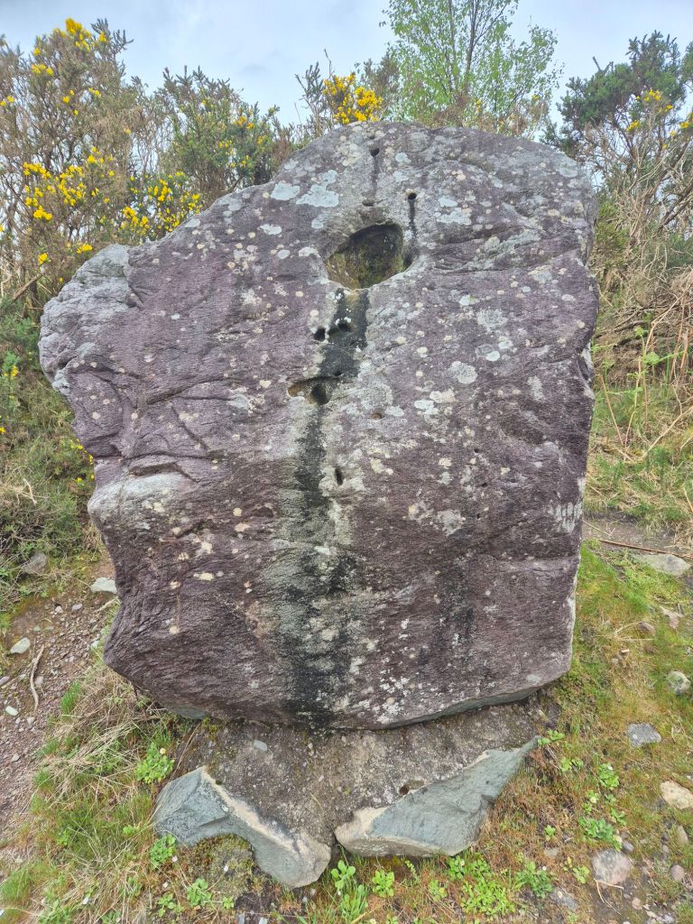
We finished our walk with some delicious fish & chips for lunch, then drove towards Sheep’s Head, the next peninsular along the coast. Along the way we stopped to look at some standing stones in a field.
We stopped for a hot drink at the cutest art & craft gallery, and with the rain starting as we left and getting heavier, we headed for our base. Tonight we’re trekking to the pub to hear some music. Apparently it draws quite a crowd from the local area-the pub is already quite full and the musician isn’t even here yet.
Some time later…
Ok, so it turns out the evening is a series of performances by people at the pub, of varying abilities, who volunteer to sing an Irish ballad, a capella, wherever they’re sitting. The pub is silent, except for the one person’s voice, and when the crowd joins in on a line or two of the chorus. One song was sung in Gaelic. The evening was certainly something we’ve not seen or heard before.
Today we wanted to drive the famed Ring of Kerry, so we headed in that direction.
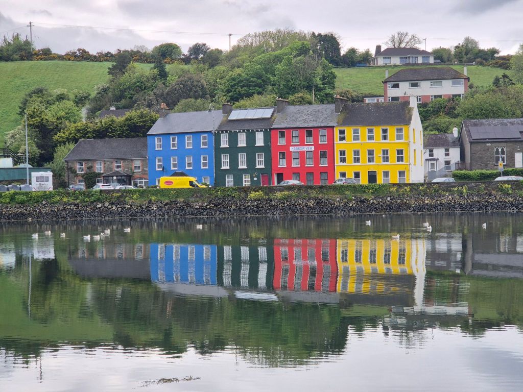
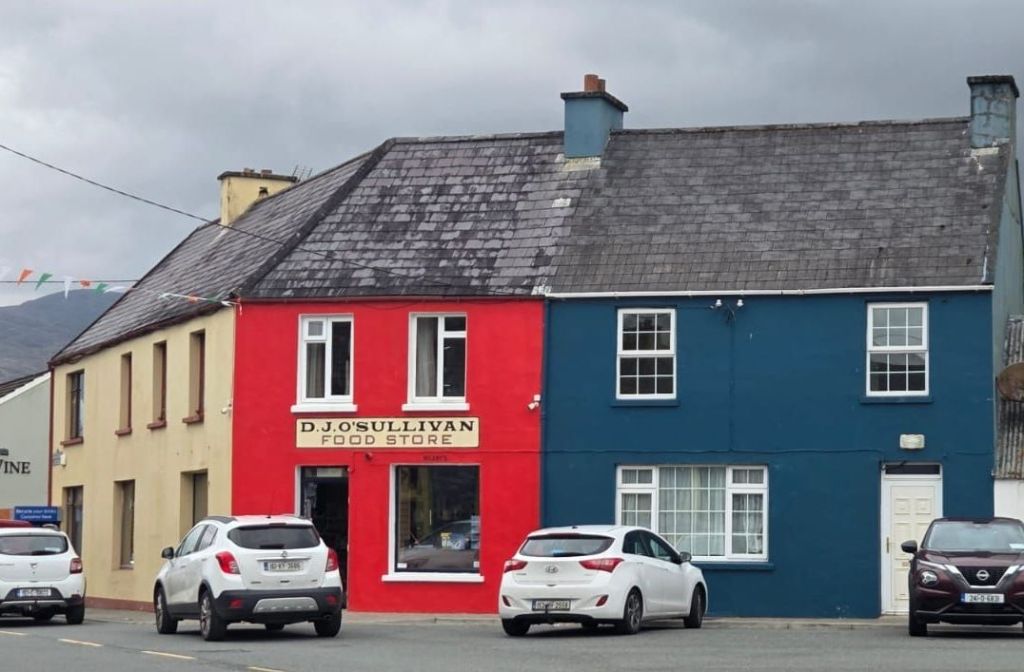
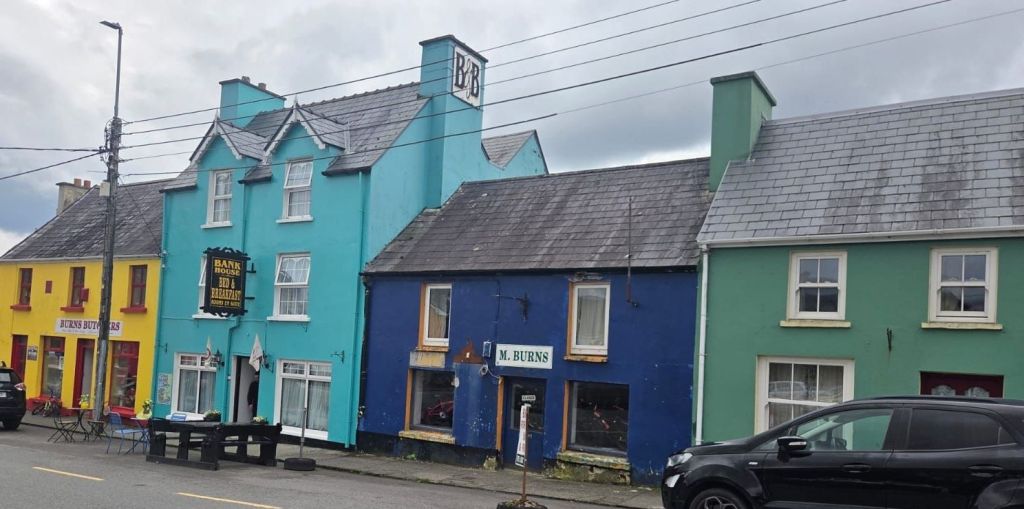
We passed through the lovely town of Bantry where the car park floods at high tide! The town had many colourful houses-they make a town feel cheerful!
We drove over the Caha Pass and through the Kerry Tunnels. This is seriously stunning landscape.
In the town of Bonane we stopped at Lorge Chocolatier for a coffee/hot chocolate. We also bought some treats for us for the next few weeks. Nearby was Bonane Heritage Park. We walked the paths up the hill to see a round fort, a stone circle
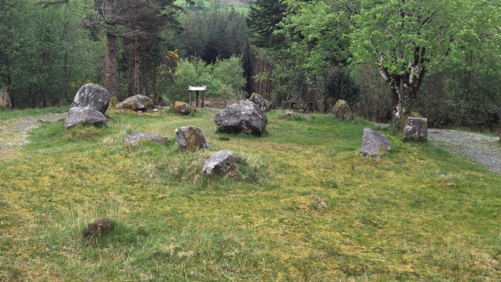
and some standing stones.
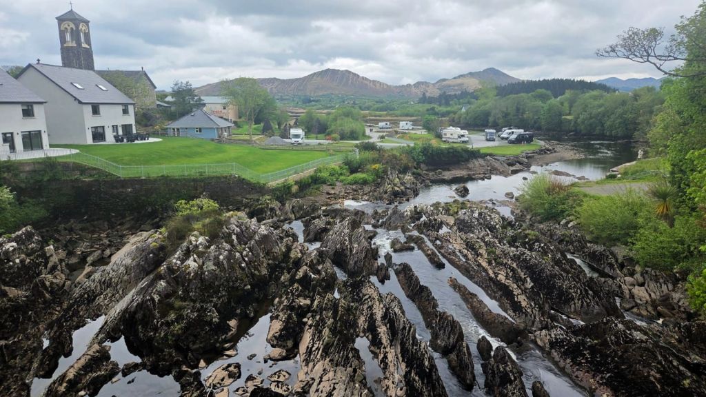
Arriving at Kenmare we turned onto the Ring of Kerry road. The town of Sneem was our first stop. It’s a gorgeous little town with colourful buildings
And the most stunning river bed we’ve seen. It’s all rock, the river runs between the blades of mostly black rock. It is quite dramatic. I don’t know that photos show this sufficiently.
We also bought a piece of award winning black pudding from a butcher who recommended we cook it for a few minutes and serve with raspberries or strawberries. We’ll report back on how this tastes!
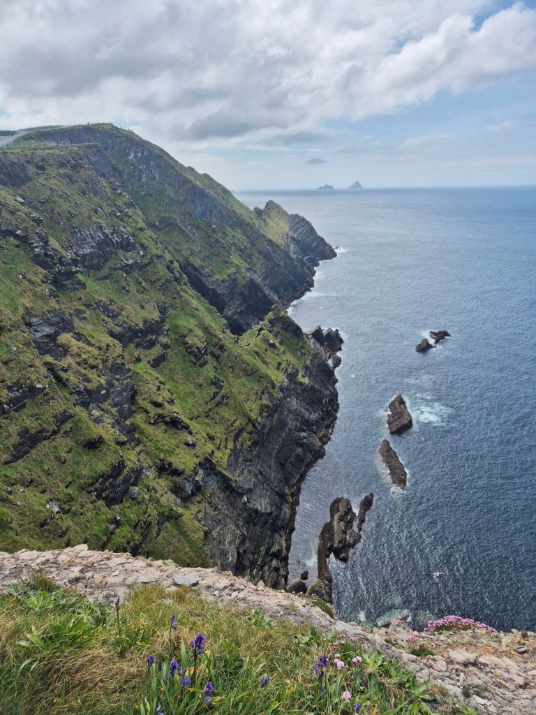
We continued our scenic drive around the peninsula to Ballinskelligs,
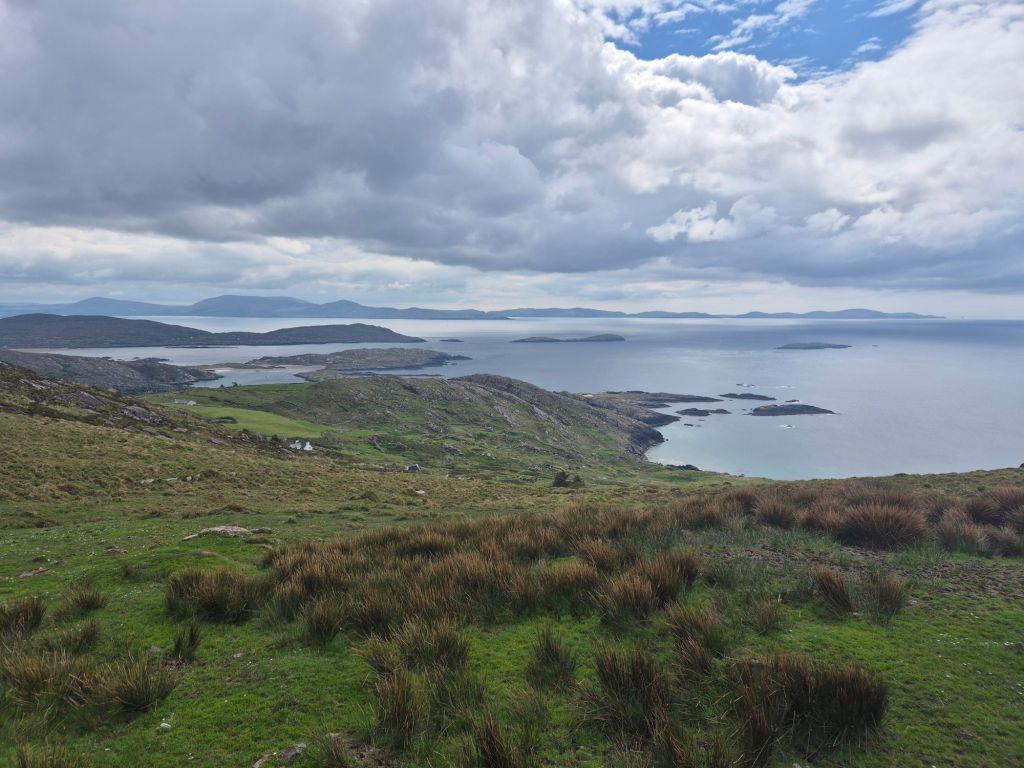
St.Finans Bay,
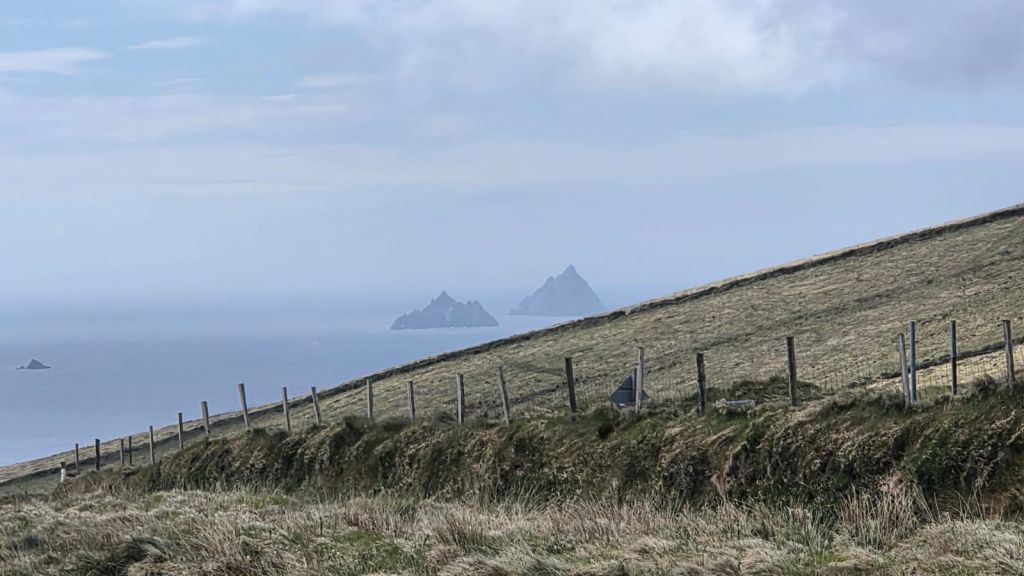
Coomanaspig Pass,
and the Kerry Cliffs.
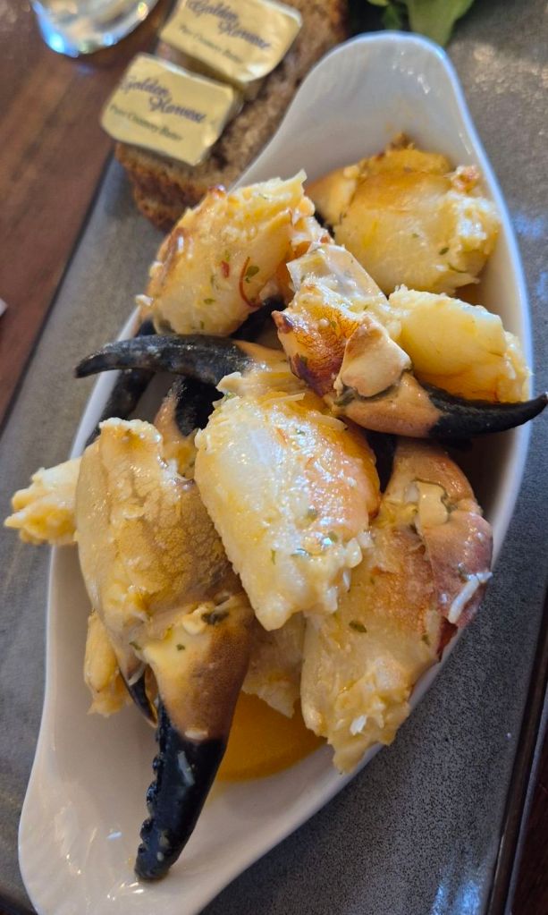
By now it was mid afternoon and we were thinking about lunch. We had been recommended the Fisherman’s Bar in Portmagee and it proved to live up to the hype. We shared a plate of crab claws and some fish & chips. Delicious!
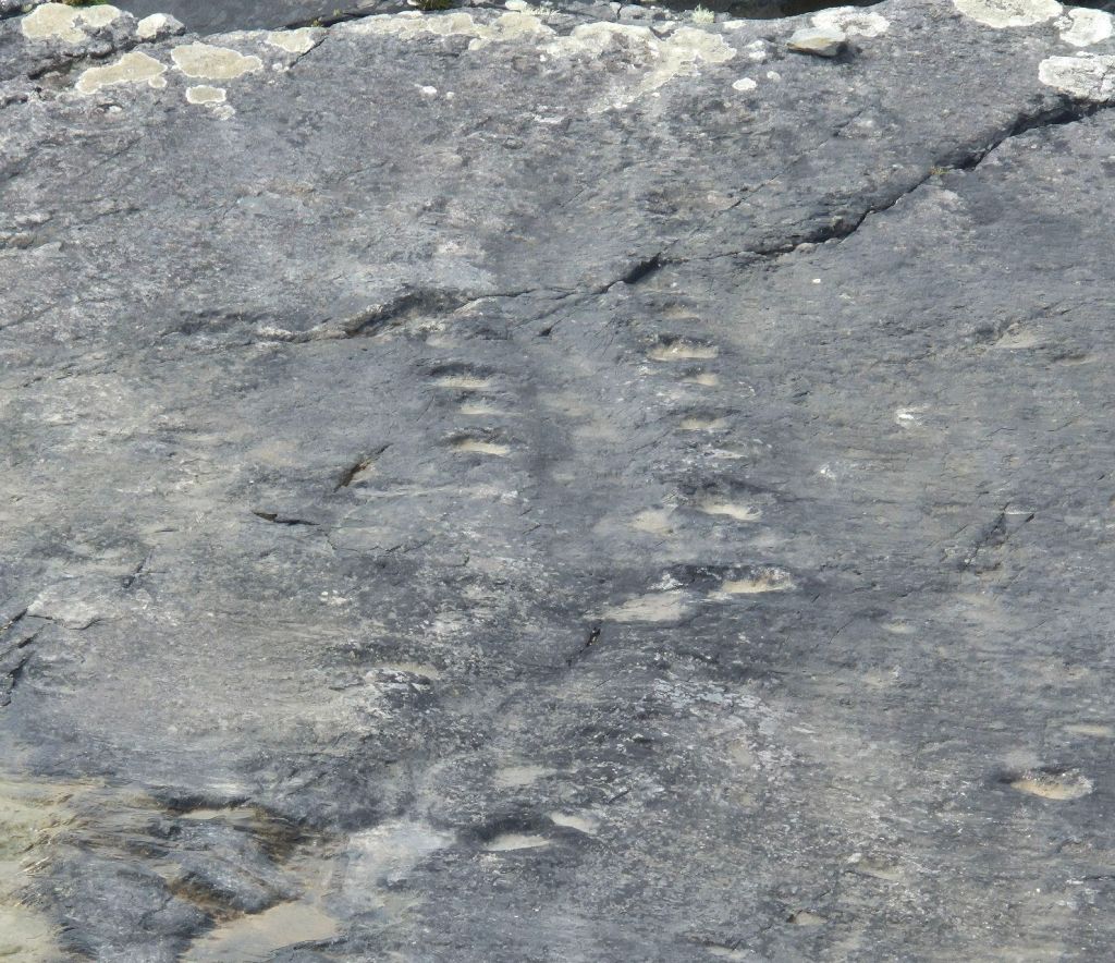
After lunch we crossed the bridge onto Valentia Island to go and see the Valentia Tetrapod Trackway. This is fossilised prints of what is believed to be the first vertebrate to walk on land.
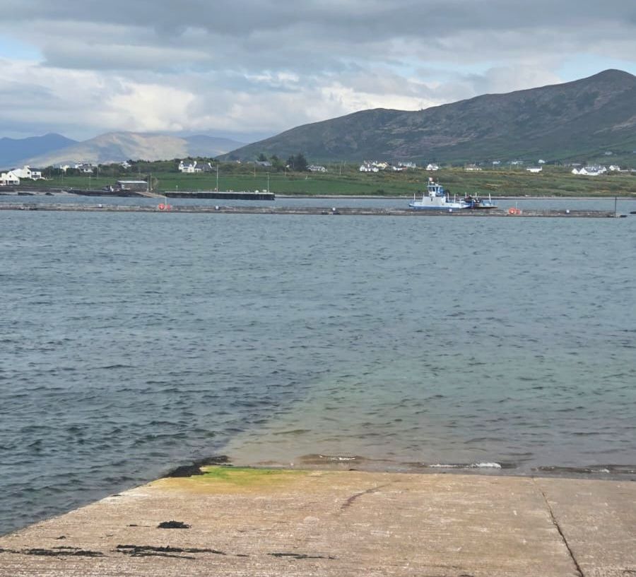
We took the car ferry from Valentia Island back to the mainland. The ferry crosses a small strait that appears to have a strong current, the ferry faced into the wind for half of the journey!
We drove back to our accommodation, stopping along the way at various roadside sites and views. One was Daniel O’Connell Cathedral-one of few Catholic churches named for a lay person. At one short stop, a man approached Kevin speaking Spanish. He was disappointed to discover we were two non-spanish speakers who are driving a Spanish registered vehicle. He lives in Ireland and was excited at the thought of having a conversation with someone who is Spanish!
It was a long day that passed quickly.
Today was a relocation day, essentially heading north by three hours according to Google. Somehow that took closer to six hours!!
A bit of a late start to our day today which was nice. We packed up and left our pub-side accommodation and drove a wide range of country roads.
We had one stop off at an amazingly intact ruin of Kanturk Castle.
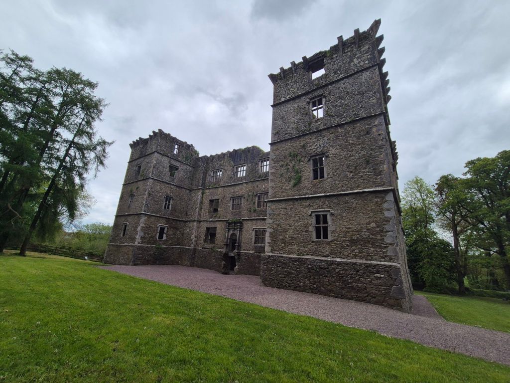
We could walk inside (most of these ruins have trees and shrubs inside) and look straight up at the sky, able to see where floor joists and fireplaces once were. It used to have a large formal garden when it was built in the 17th century.
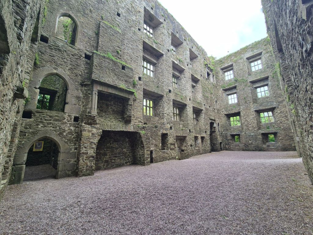
It was given to the National Trust by the owners in the early 1800s.
From there we drove to Limerick, stopping to buy some binoculars-once again we left ours at home!! These will be used plenty in the next few months.
We headed north again and realising we would be passing the village of Whitegate, set course for a relative’s house, where my Great Great Grandmother lived before leaving Ireland.
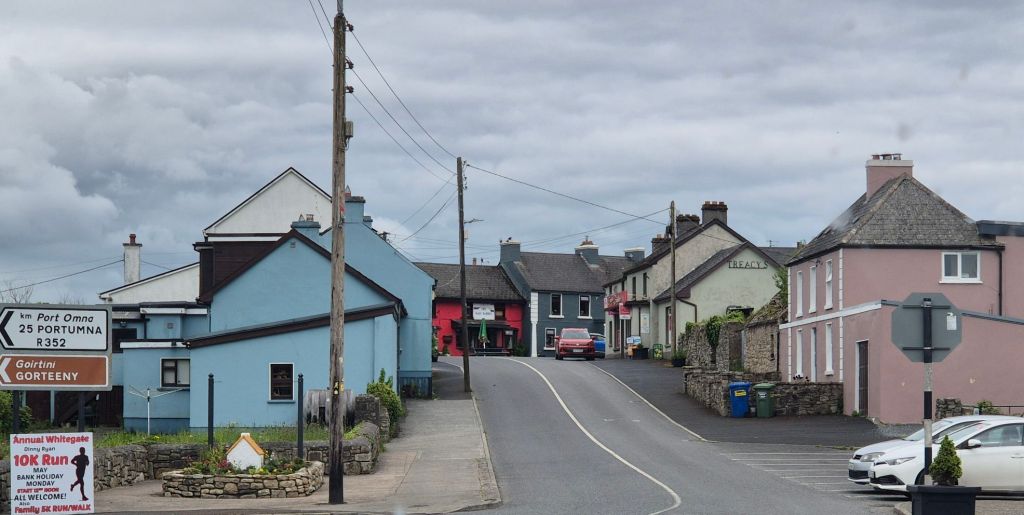
I’d been given directions by Mum before leaving. She last visited in 2008. Unfortunately Alfie wasn’t home, so I left a note.
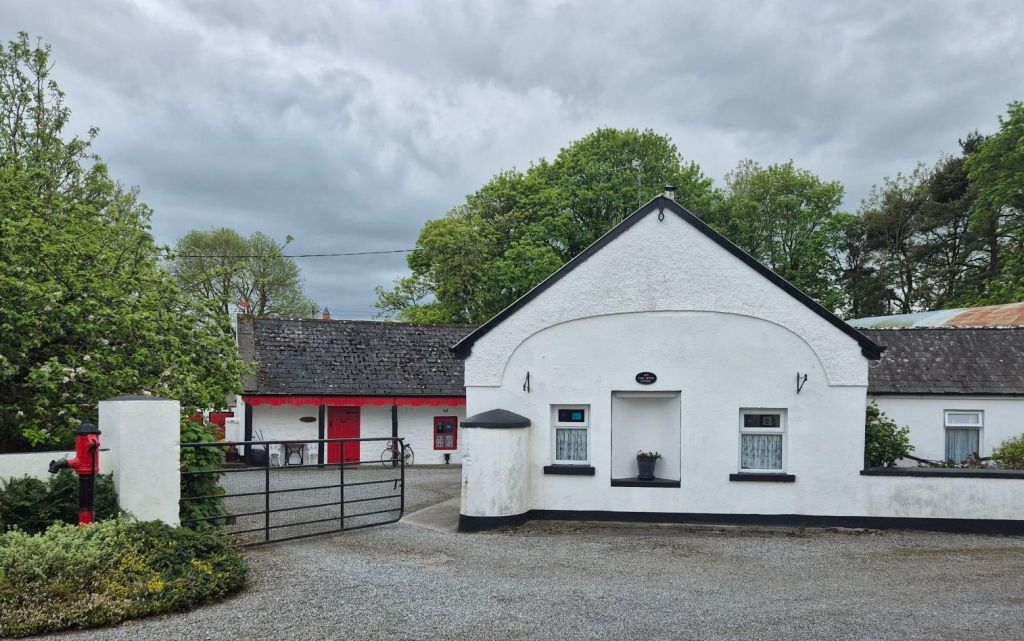
We stopped at a supermarket to buy some groceries and arrived at our gorgeous 300year old accommodation for the next few days.
We’re currently sitting by a warm peat fire with a roast in the oven and a pot of soup made, ready for tomorrow night’s dinner. Wine obviously in glasses.
Today was a very early start as we needed to make a 9am ferry to Inis Mór, the largest of the Aran Islands. This was a last minute decision really, based on (brilliant) advice from Eammon, our host/publican in Drinagh.
We seem to have made a bit of a mistake choosing our accommodation locations-we selected somewhere that appeared central to multiple sites when looking at a map, but is not actually close to any of them. It’s a bit like booking accommodation in Toowoomba to see the sites in Brisbane or the Gold Coast. (Doh! We won’t make this mistake again!) On the plus side, we are seeing lots of the countryside on our drives and that’s been interesting.
So anyway, we left when it was 3 degrees – our cosy cottage was still cosy – it was 7 when we boarded our ferry and it is currently the daily high of 12, but it feels so much warmer as we have been blessed with sunshine and light breezes all day. We could not have booked better weather if we’d tried.
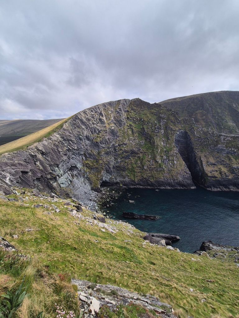
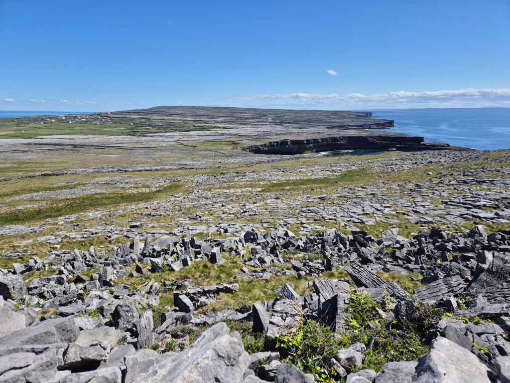
Arriving on the island of Inis Mór we joined the short and quick moving bike rental queue and were soon off on our e-bikes. We took the Green Path along the coast to the western end of the island, stopping along the way to look at some seals basking on a rock just offshore.
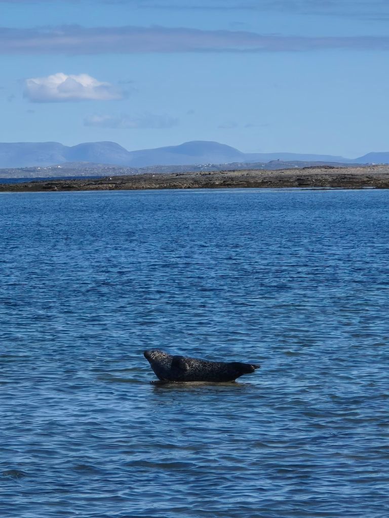
One seal had the rock to himself and the one pictured came along and challenged him for it. There were four or five seals bobbing around in the water as well.
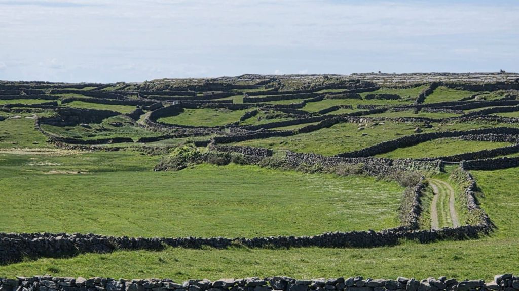
The dry-stone walls marking field boundaries are an interesting feature, visible in every direction.
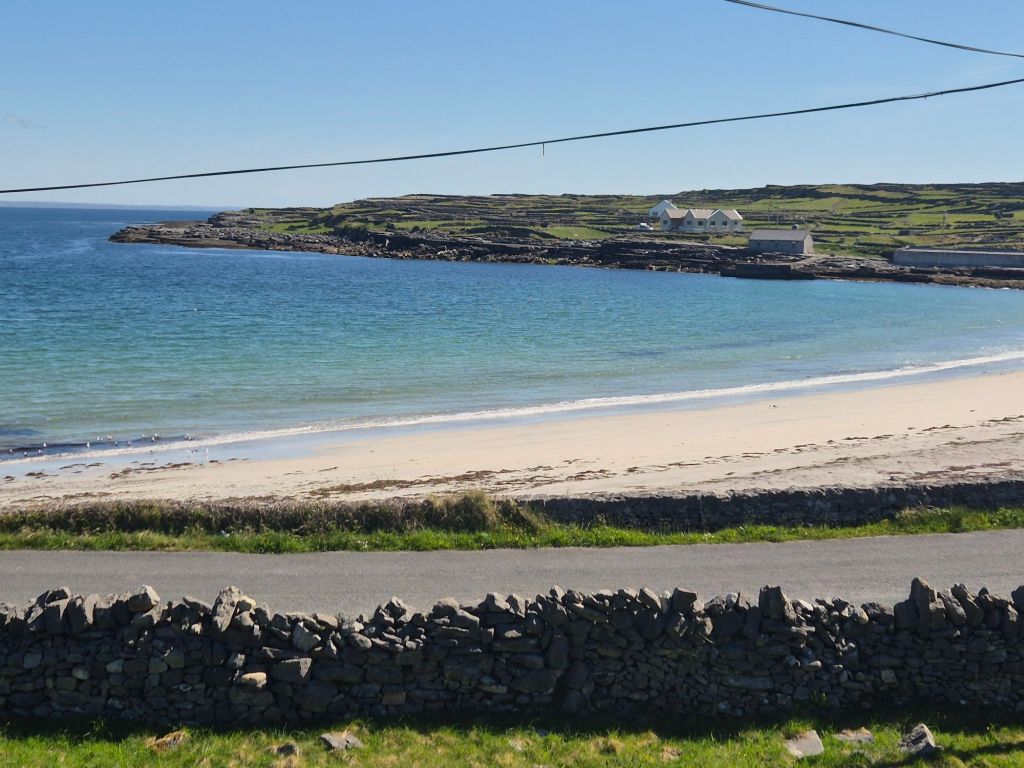
We rode out past a gorgeous beach
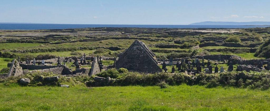
to Na Seacht dTeampaill – The Seven Churches, a graveyard with the ruins of (shocker) seven churches that had been built over the years.
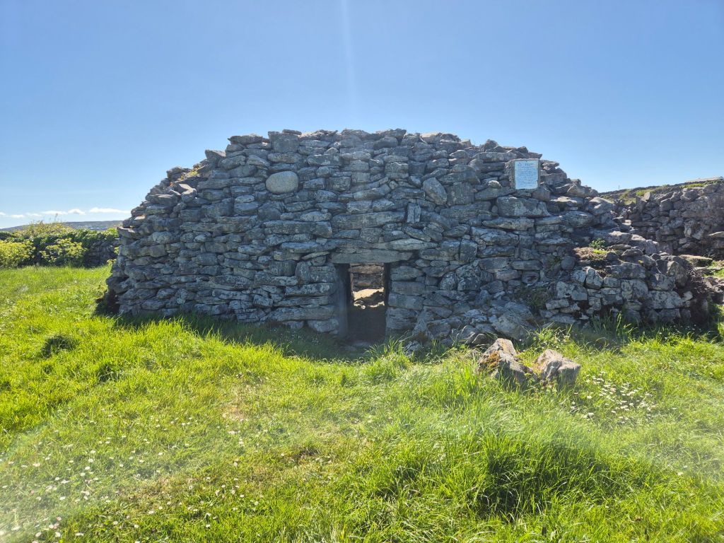
We then went to see Clochan na Carraige, the biggest and best preserved beehive hut in the Aran Islands.
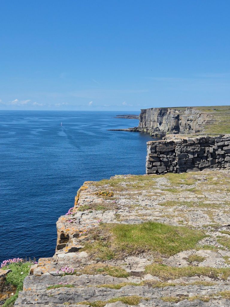
We then rode towards Dún Aonghasa, and ancient fort located on the cliffs. Stopping for a spot of knitwear shopping on the way.
The views from the fort were amazing.
We rode back into town on the Red Route, stopping at a pub for a well earned pint of Guinness.
There may have been some more knitwear and some delicious fudge purchased in town before we returned our bikes and queued up for the return ferry.
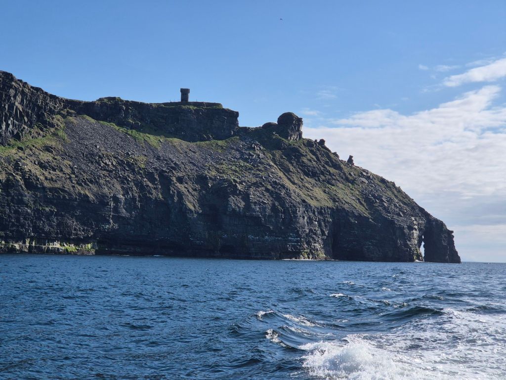
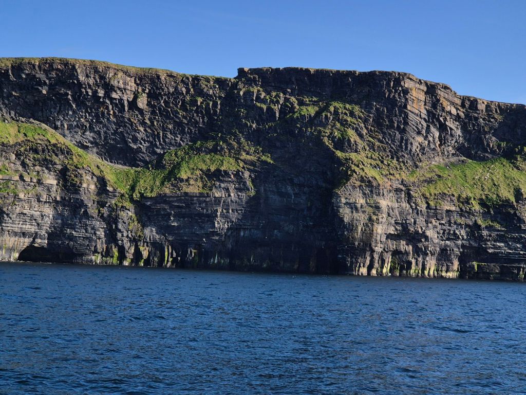
When our ferry docked we quickly boarded the other one that was waiting, for a tour of the Cliffs of Moher. The boat went along the cliffs so we had a great view; they also provided some commentary about formation, history, features and wildlife.
We disembarked and headed home, arriving very happy that we only needed to heat a pot of soup for dinner to be ready! It was a long day.
We started today without an alarm, then headed back towards Doolin and the Cliffs of Moher.
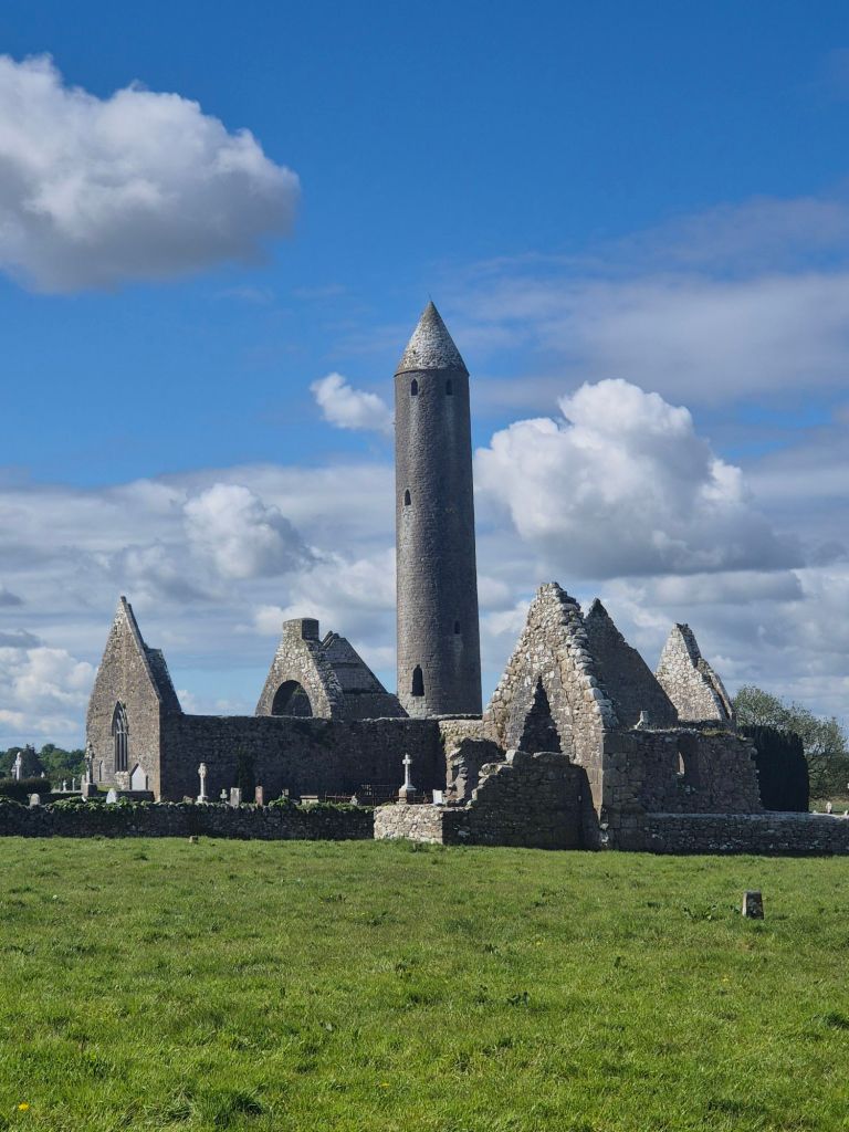
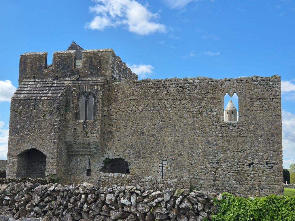
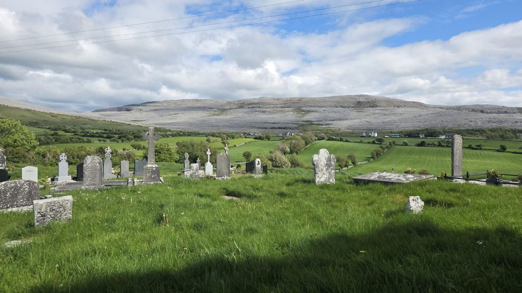
We stopped at Kilmacdaugh, where ruins of several churches and abbeys stand alongside an Irish Roundtower and a large graveyard.
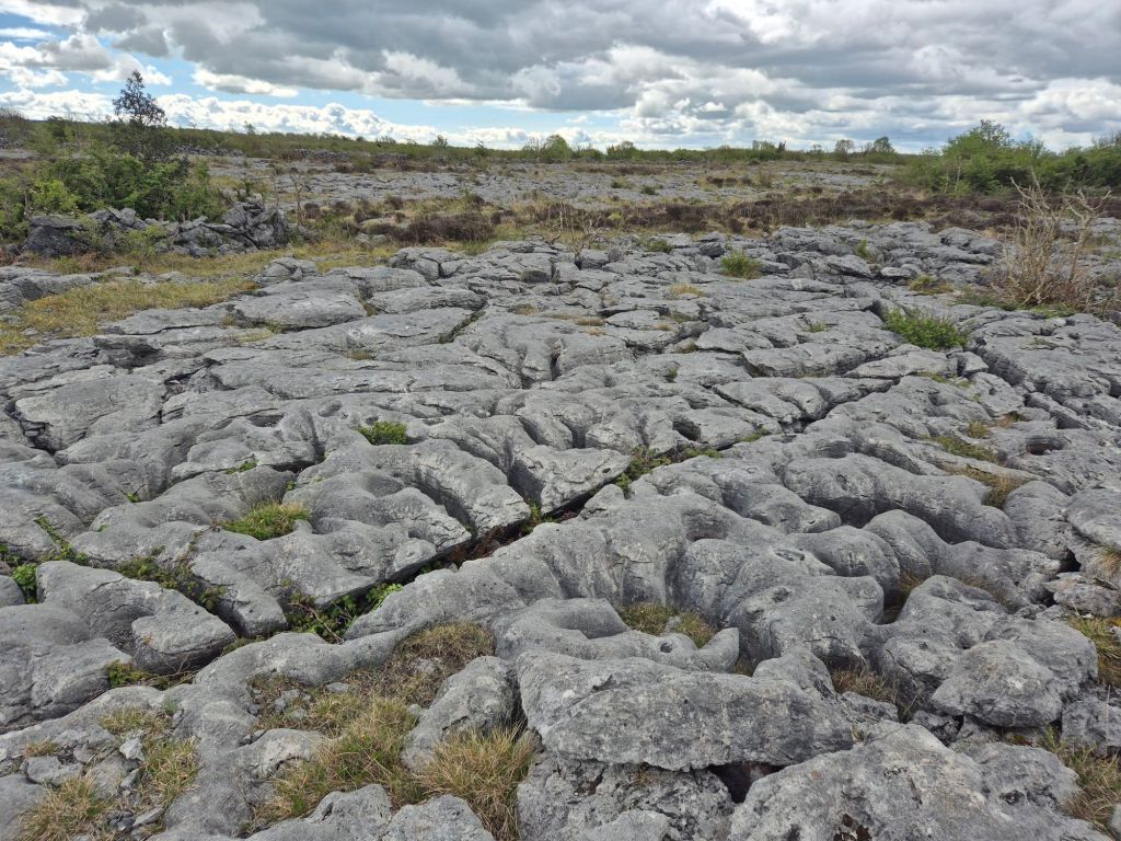
Next stop was the edge of The Burren where the rock starts to flatten and merge with farmland. The patterns and shapes are amazing, with some quite deep crevices between them and plants growing in the bowls and gaps also.
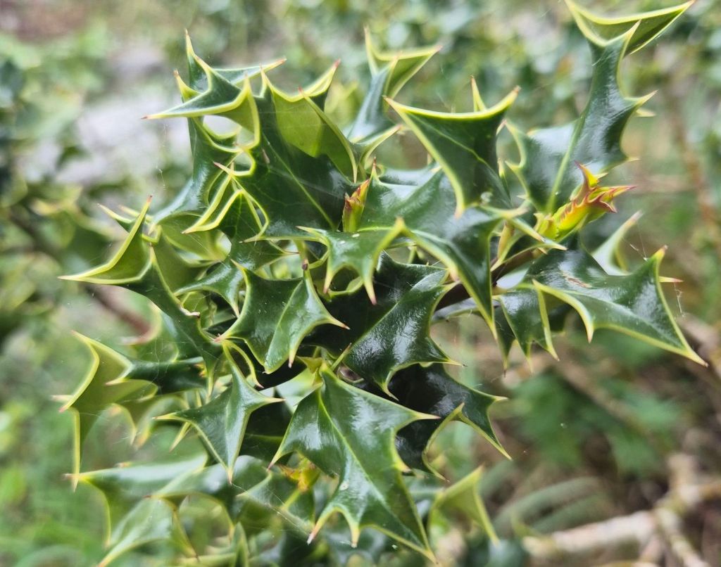
We also saw & felt a real Holly plant here!
We had originally planned to walk some segments of the cliffs, but seeing that all direct access paths were closed and after yesterday’s boat ride we figured we had actually probably seen them in detail, we decided not to join the crowds.
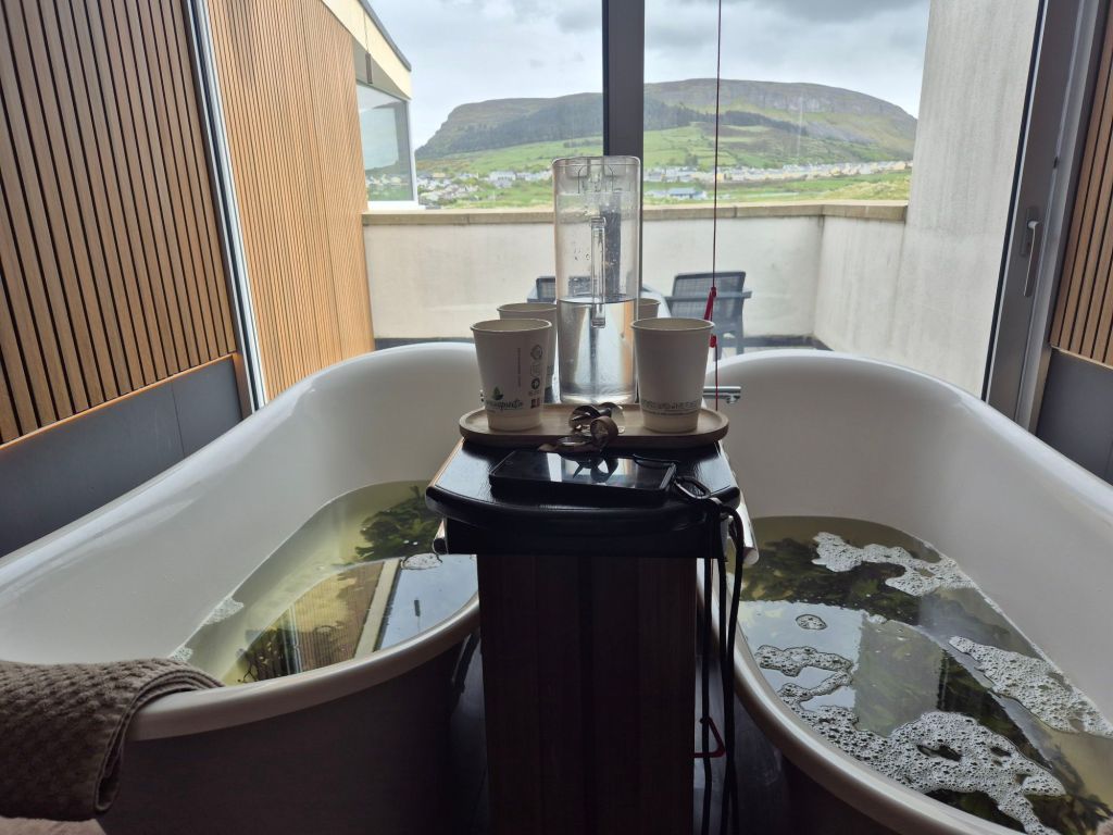
Instead we headed straight to our planned activity, a hot seaweed bath, in a barrel, at the edge of the sea. This was such a fun and relaxing activity in a unique location.
The barrels are filled with hot seawater, pumped directly from the ocean-they must have a boiler hidden somewhere. It took a little bit of Twister-like positioning to fit both of us in up to our shoulders. The man then dumped a bucket of seaweed, collected this morning and soaked in hot water to activate it.
The seaweed released a slimy gel that is apparently so good for you! We also had a hose to add more hot water when we wanted some.
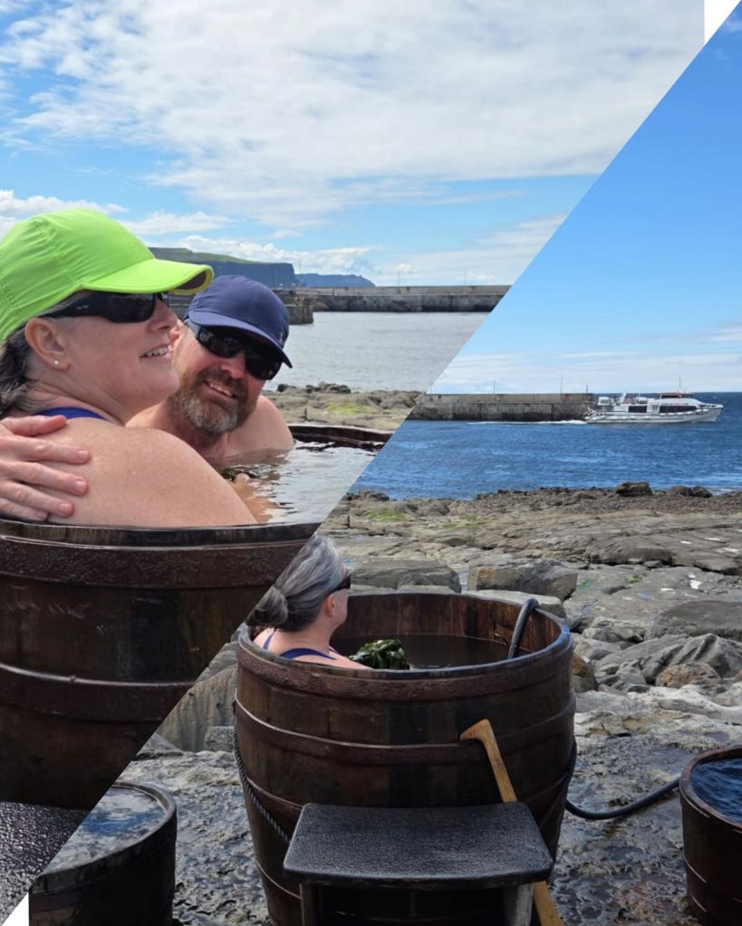
It was relaxing and warm, and them cold in the wind when you got out of the water.
After drying off and changing we went into town and had some fish & chips, a crumbed goats cheese salad and a Guinness for lunch before doing a spot of browsing/shopping in the many wool and craft stores.
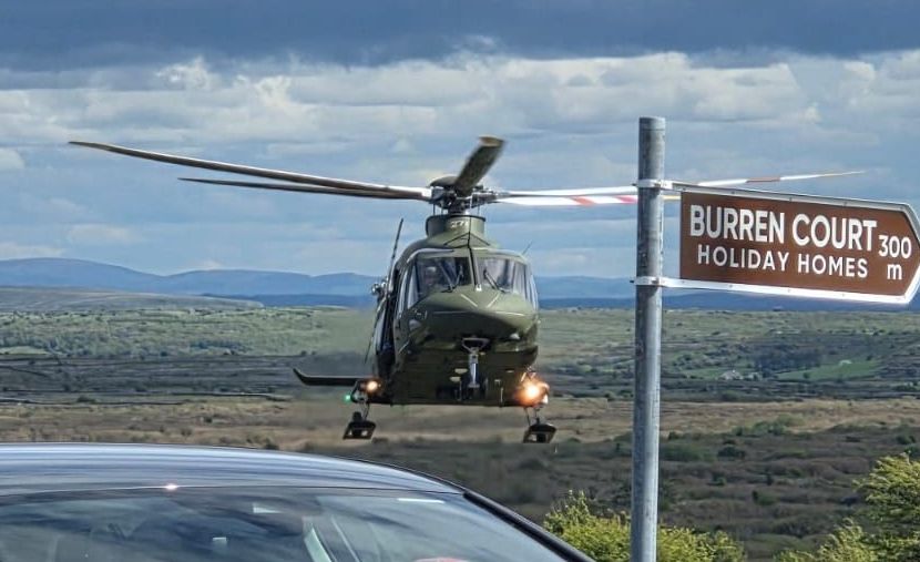
We headed home by a different route. Our drive was paused as we waited for a helicopter to land, take a passenger and leave again. A motorcyclist had crashed on the road a bit before we came through. He was apparently not in critical condition but the helicopter was to get him to hospital as quickly as possible
A little further along the road at a place called The Corkscrew, we watched as three buses navigated the hairpin turns and each other, whilst looking at the hills of The Burren.
A little further along we stopped for another photo closer to one hill.
Today was a transition day, but that doesn’t mean doing nothing.
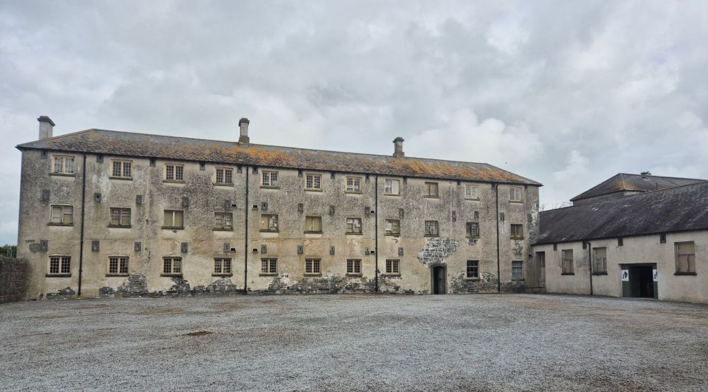
We left our accommodation and headed to the Irish Workhouse Centre in Portumna just 8km away. We saw the sign for this as we were driving past the other day and booked tour tickets. There were many workhouses built in Ireland between 1820 and 1852. The majority were built before the famine that killed a million people in the mid-1840s to the early-1850s. The workhouse in Portumna was opened in 1852.
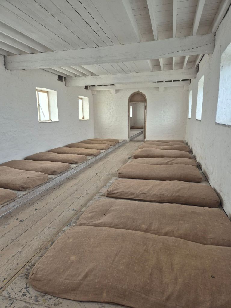
The poor, upon entering the workhouse as a family, were separated from their families. There were four dormitories, one each for men, women, boys and girls. Once inside, inmates (yes that’s what they called them) didn’t see most members of their family until they left. Living conditions were poor to say the least. Food was scarce and made more scarce by the manager skimming what they did have. Sanitation was lacking, but for the poor it was a step up from what they had as they were no longer accruing debt on rent they couldn’t pay.
They slept in dormitories on a mattress on the floor, the large rooms had 10 airflow holes and one small fireplace-many people died of hypothermia instead of starvation.
We had an excellent guide, Aron who took you back to those bleak days.
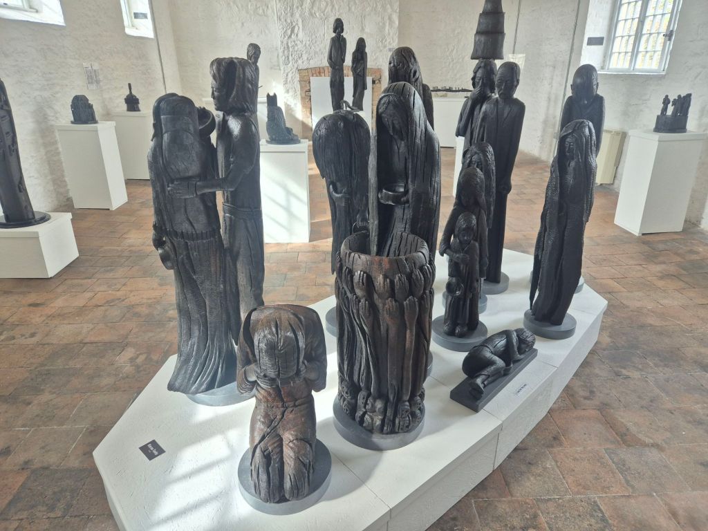
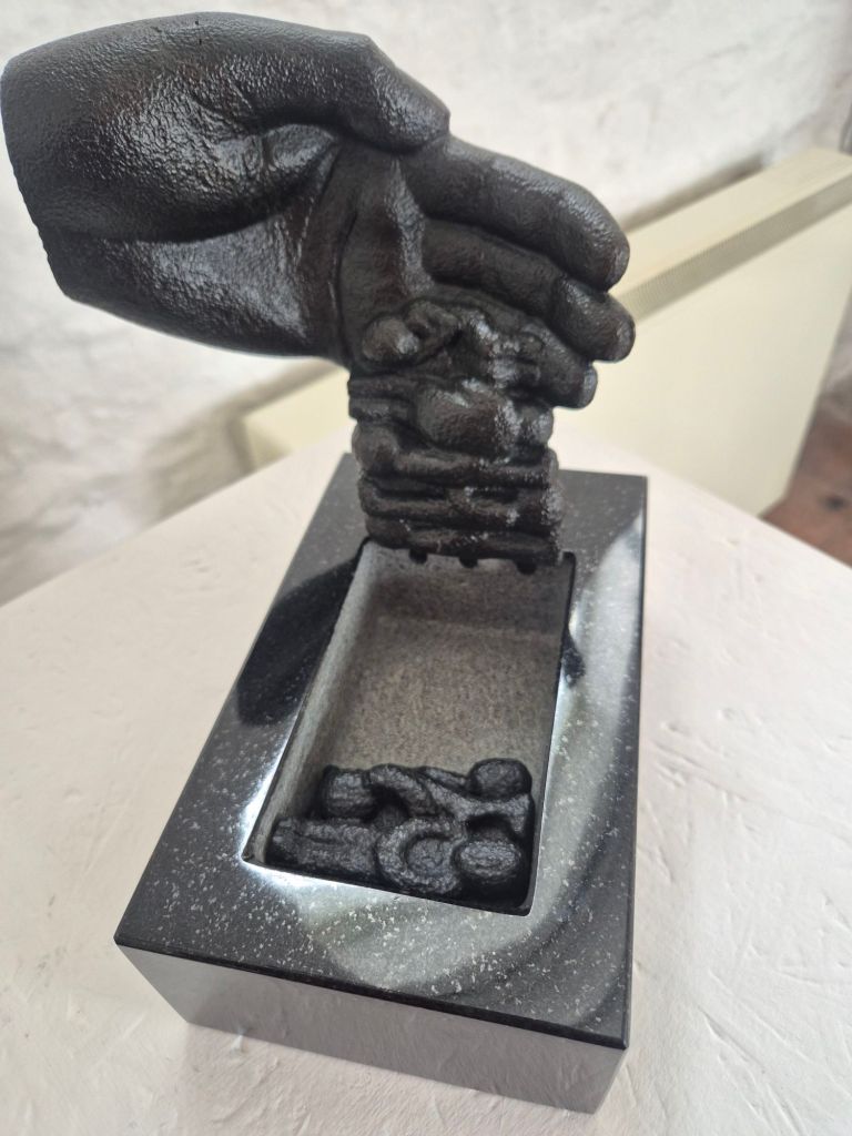
The museum also had an exhibition of bog oak sculptures by a local artist. The sculptures were all about the famine, workhouses and people leaving Ireland. They were beautiful and moving.
From there we headed north towards our accommodation for the night that is 100km from where we thought it was. (So many bookings being made that sometimes it’s hard to think straight!)
On the way we had seaweed bath #2. We had actually booked this one before we saw the seaside barrel one. Can never have too many warm baths! Today’s seaweed bath was the posh version. Indoors, a steam shower, a bath each, a plush bathrobe, peppermint tea to drink…however the view yesterday was better.
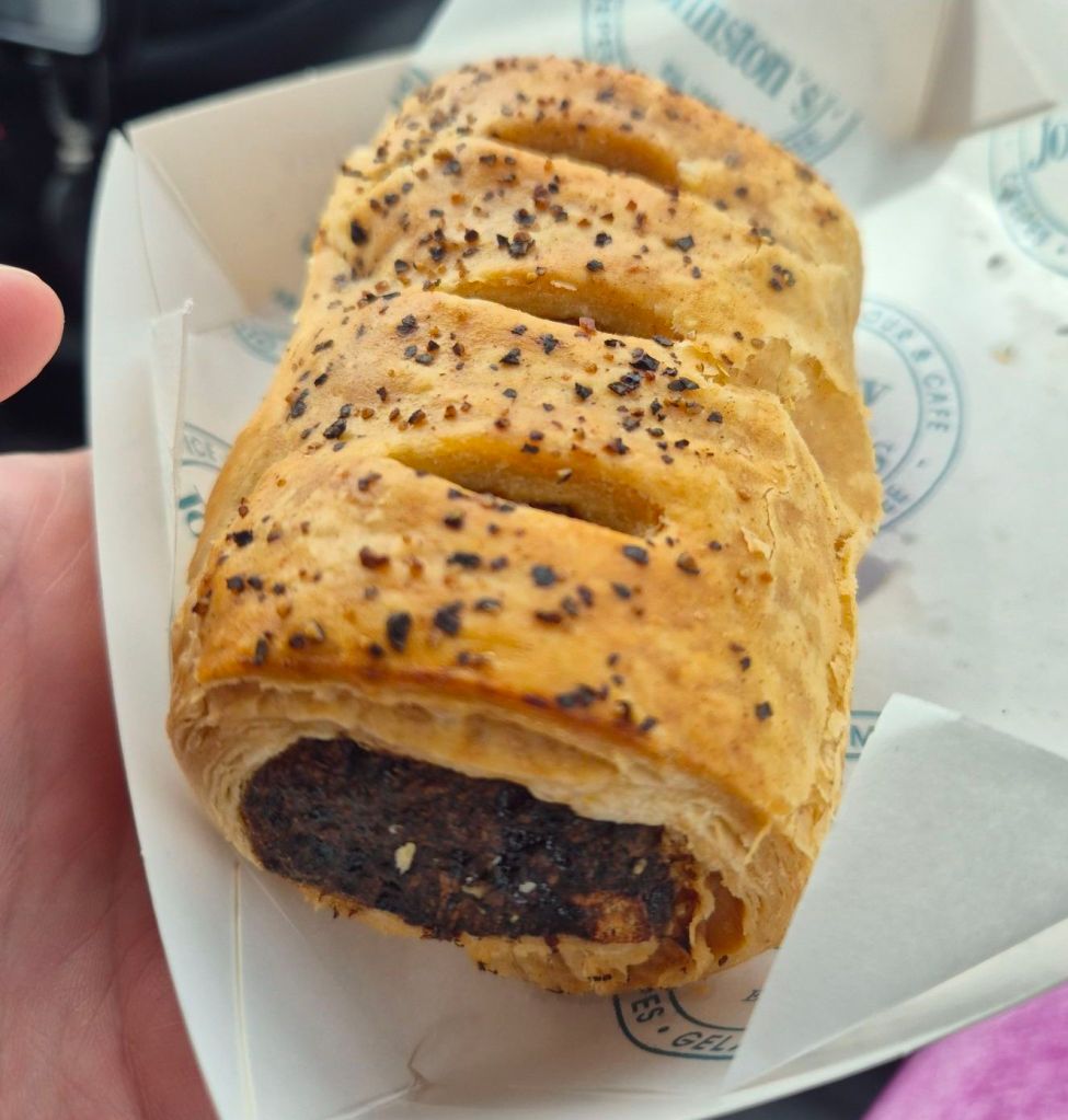
Very relaxing. It was after 3 when we finished so we grabbed a black pudding sausage roll from a bakery as we walked back to the car to keep driving. It was fantastic!
We are now at our accommodation on Achil Island, fed on leftover roast with a Guinness in front of us and live music playing in the corner. Idyllic.
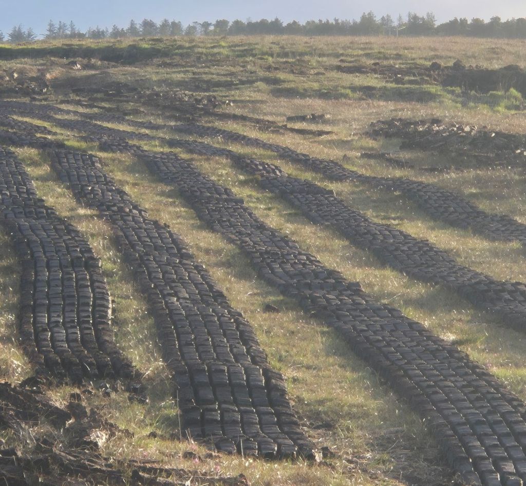
We’re leaving the Wild Atlantic Way behind today and heading inland. On our way off Achill Island we stopped to look at the peat bogs and the cut bricks drying that we noticed yesterday on our way in.
Trip note:
This “unplanned” thing has pros and cons. We went to book ferry tickets and accommodation for our intended week on the Shetland Islands. The ferry is fully booked for all of May/June and there are only about 4 places left to stay, two of which are tents with no facilities! So we had to got to plan B. Desperately trying to find something else to do for that week. The Orkney’s? The Outer Hebrides? Nope. Faroe Islands! We’ve both wanted to go there since we went to Iceland in 2022 and had been disappointed that we probably wouldn’t be able to get there this year. However, with not being able to go to the Shetlands, we now get to go to the Faroe Islands. We’re excited.
We now just need to start looking at the rest of Scotland before we end up under a 3 star tree!


Leave a comment…